

Miami Standard – A powerful storm system is set to bring widespread severe weather across the Midwest and South this weekend, before shifting eastward to impact the East Coast by Monday.
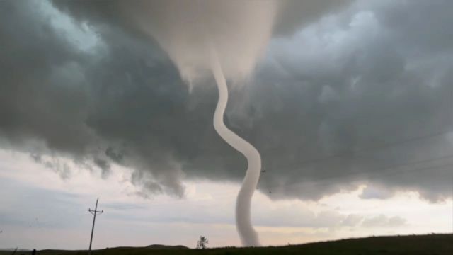
Forecasters warn of strong tornadoes, damaging winds, and large hail, particularly in areas already hit by a major severe weather outbreak two weeks ago.
Severe Weather Timeline and Affected Areas
Saturday Night: Severe storms could begin developing across the Plains, with large hail and strong wind gusts being the primary threats. Tornadoes, while less likely, cannot be ruled out. The highest risk areas include northeast Oklahoma, eastern Kansas, and western Missouri, covering cities such as Wichita and Kansas City.
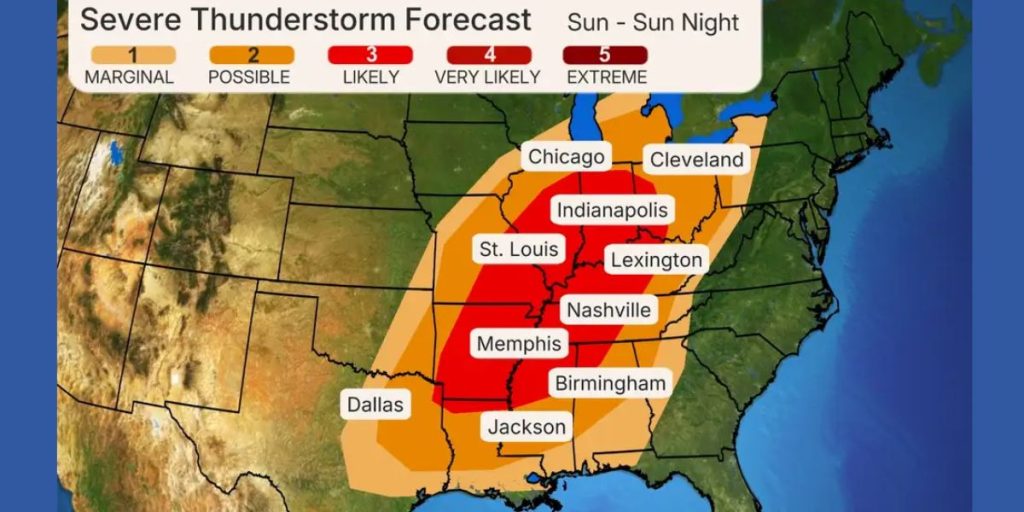
Sunday-Sunday Night: Severe weather will intensify, spreading from eastern Texas to the southern Great Lakes. Areas at highest risk for large hail, damaging winds, and strong tornadoes (EF2 or higher) include St. Louis; Indianapolis; Little Rock, Arkansas; Louisville, Kentucky; and Memphis and Nashville, Tennessee.
Severe weather could persist into the late evening and overnight hours, particularly east of the Mississippi River. Authorities urge residents to have a reliable way to receive emergency alerts, as storms may strike while people are sleeping.
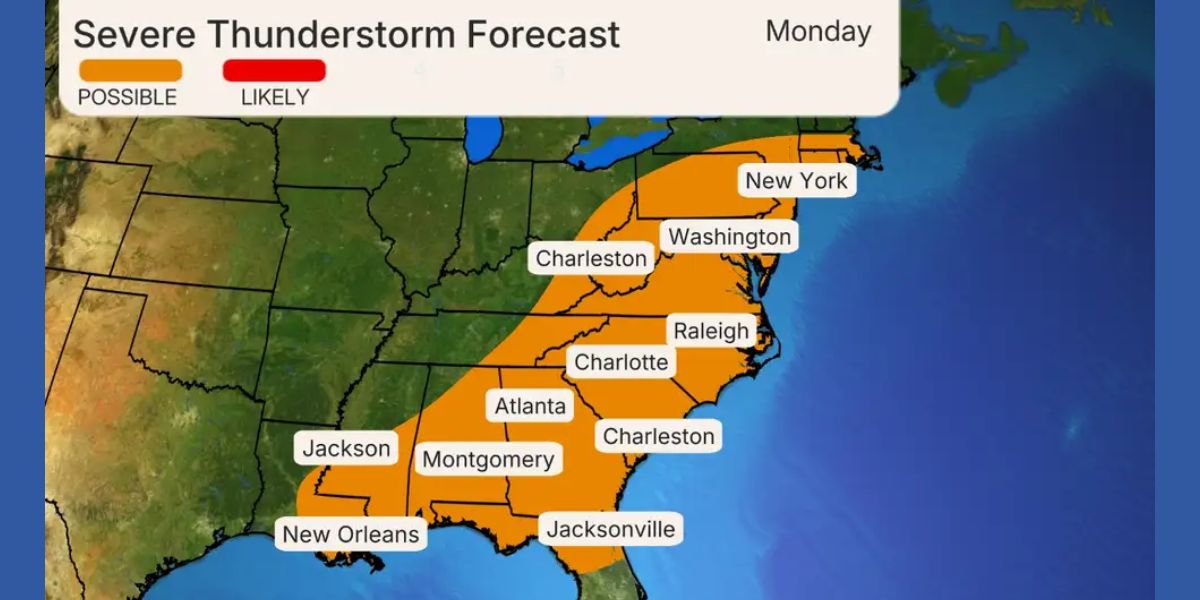
Monday: The storm system will continue its path, bringing severe weather from the Southeast to the mid-Atlantic and Northeast. Cities potentially affected include Atlanta, Charlotte, Raleigh, Jacksonville, Columbia, Washington, D.C., and New York City.
The biggest threat for the mid-Atlantic and Northeast will be damaging winds. However, in the Southeast—from the Carolinas to Georgia and the Gulf Coast—storms could also bring large hail and a slight tornado threat.
A Springtime Setup Driving the Storms
This multi-day severe weather event is fueled by a classic spring weather pattern. A sharp dip in the jet stream from the West is meeting warm, moisture-rich air from the Gulf of Mexico, creating the perfect conditions for supercells and strong storms. A powerful low-pressure system, moving from Kansas to New York, will add further instability, increasing the likelihood of severe weather across multiple regions.
Stay Alert and Be Prepared
Authorities are urging residents in the affected areas to stay updated with the latest forecasts and have emergency plans in place. Given the potential for nighttime tornadoes and rapidly developing storms, it is crucial to have multiple ways to receive weather alerts, such as NOAA weather radios and smartphone notifications.
As the storm system progresses, meteorologists will refine predictions on the most at-risk areas. Residents in the path of the storms should monitor updates from the National Weather Service and local emergency management officials.