Southeast Michigan is bracing for a dynamic weather pattern on Wednesday, with accumulating snowfall in the morning followed by two rounds of severe storms that could bring hail, flooding, and even tornado threats.
Rain-Snow Mix Overnight
A mix of rain and snow is expected to move into the region shortly after midnight on Tuesday, continuing into early Wednesday morning. As temperatures drop, areas north of I-96, especially north of M-59, are likely to see snow accumulation.
The wintry mix is expected to taper off by 7 a.m. or 8 a.m., with slight accumulations possible. While temperatures will rise quickly throughout the day, areas north of M-59 could see a trace of snow, while those north of I-69 may accumulate over an inch.
First Round of Storms Wednesday
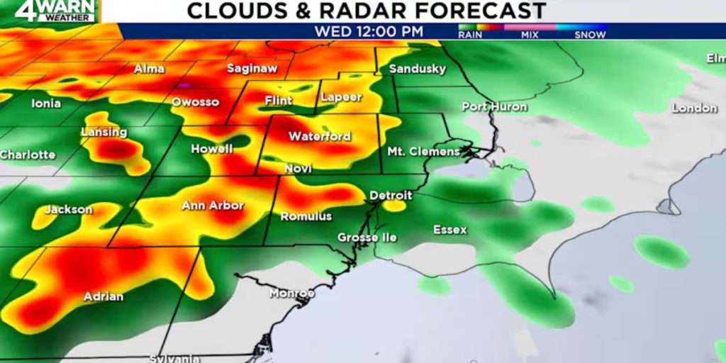
The first round of storms is forecast to hit around midday on Wednesday, bringing the potential for severe weather, including strong winds and heavy rain.

Severe Weather Wednesday Night
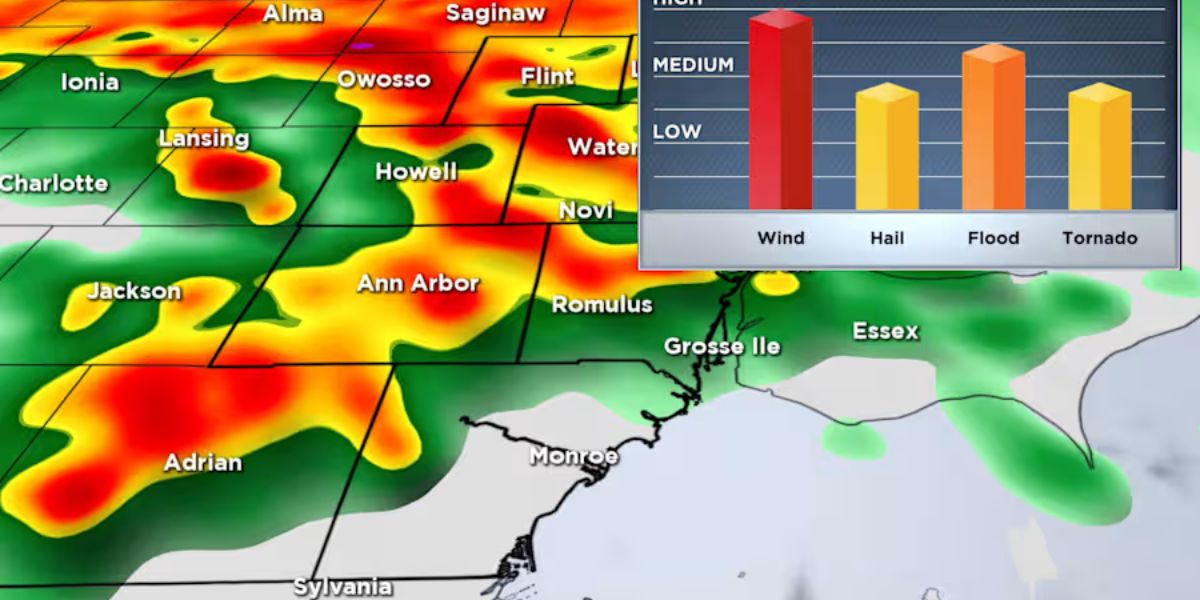
A second, more intense wave of storms is expected after sunset and will continue until midnight. This round poses a greater risk, with damaging winds being the primary concern. Some areas could receive up to 2 inches of rain, leading to potential flooding.
While the hail and tornado threats remain lower than wind and flooding risks, they cannot be ruled out. Southeast Michigan is currently under an enhanced risk (level 3 of 5) in some areas, while others are under a slight risk (level 2 of 5). Due to these concerns, a 4Warn Weather Alert has been issued for Wednesday.
Looking Ahead: More Rain and Snow
The unsettled weather pattern is expected to continue into the weekend, with another round of rain likely on Saturday, possibly extending into Sunday.
Early next week, temperatures will drop, with highs around 40 degrees. The region may also experience lake-effect snow showers or flurries, particularly in areas downwind of the Great Lakes.
Residents are advised to stay alert, monitor local forecasts, and take necessary precautions as this volatile weather pattern unfolds.


